
Projects
Urasar Mineral District
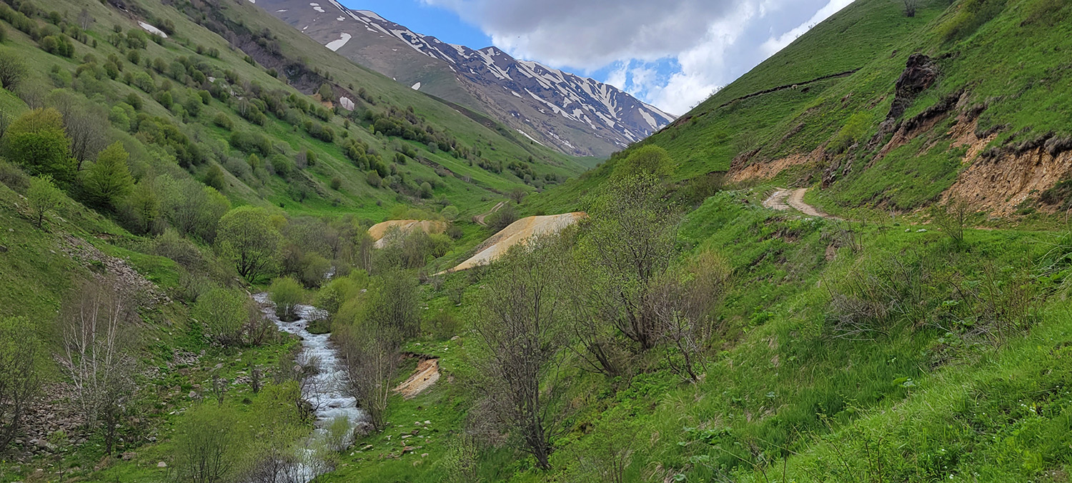
Hayasa was granted an exploration permit in September 2023 by the Armenian Ministry of Territories comprising 33.8 km2 over the Urasar mineral district in northern Armenia. No further permits are requried for drilling, trenching, road building and other basic exploration work. Due to historical work by carried out in from the late 1950s to early 70s, the area already contains most of the road network needed for exploration. Historical Soviet data from that time reveals a non-NI 43-101 compliant resource totalling 344K oz Au in the Russian C1+C2 category and 649K oz Au in the P category* in two separate zones.
*C1 and C2 are roughly equivalent to CIM’s (Canadian Institute of Mining Metallurgy and Petroleum) “indicated” category, while P is roughly equivalent to CIM’s “inferred” category
Hayasa Metals – Urasar Mineral District, Armenia
Introduction
Hayasa Metals holds a 3,392-hectare exploration license over the Urasar Mineral District in northern Armenia. The project spans a 15km mineralized corridor following the Yellow River and Black River valleys. The geology comprises oceanic ophiolites thrust over Tertiary-aged volcanics, volcanoclastic, and limestones—an analogous setting to the 4+ million oz Zod (Sokt) deposit located ~100km to the southeast along the same regional-scale lineament.
Historical Background
Exploration at Urasar dates back over a century. Between 1914 and 1917, a French consortium exploited high-grade copper ores, producing ~16,000 tons at grades of 11–12% Cu. Soviet exploration campaigns followed in 1928–1932, 1936–1938, and most extensively in 1956–1960.
Key results from the Soviet work include:
- More than 20 exploration adits and 39 drill holes (most <100m depth)
- Notable intercept: 25m grading 1.67% Cu from 209–234m in Soviet hole #1 (in the Copper Creek drainage)
- Identification of three copper-gold mineralized bodies along the Chibukhlu Fault
These early efforts defined the core potential of the district, although unfortunately the Soviets did not assay for gold. However, later sampling by Hayasa demonstrates a correlation between gold and copper assays.
Recent Work by Hayasa Metals
Since mid-2023, Hayasa has undertaken comprehensive early-stage exploration, including:
- Geochemical Survey: 1,571 soil samples
- Geophysics: 240 line-km ground magnetic survey
- Geological Mapping & Rock Sampling: 297 rock chip samples
- HIRIP Survey: three individual 1300m lines-Copper Creek, Oxide Basin and Black River
- Drilling: 2,142m across 9 diamond drill holes in 2024. 2,040m across 11 diamond drill holes in 2025, late season 235m hole that returned 0.5% copper over 39m.
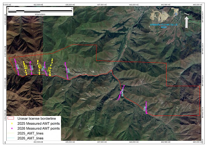
- AMT survey: 3 lines in 2025, with a 6 line program completed in May 2026.
This work confirmed a robust, 15km-long, E-W trending geochemical anomaly along the Chibukhlu Fault—anomalous in copper, gold, molybdenum, and associated chalcophile elements as shown in Figure 1, below. However, while the 2024 and 2025 drill programs intersected strongly altered, brecciated sulfide-bearing volcanic lithologies, the assays and geochemical results were sub-economic.
A reevaluation, prompted by the recovery of a Soviet-era (1960) report, revealed that the initial drill holes had targeted the mineralized zone too far south, intersecting only unmineralized footwall rocks. The historic data included:
- Partial Soviet drill logs and assays
- Channel samples from underground adits (Golden Vein area)
- Historic underground plans and cross-sections
Project Location
The Usasar project occurs in the Lesser Caucasus Mountains, within the NW-SE Seven-Amasi metallogenic/suture zone, part of an intensely folded province containing ophiolites that represents the closure of the ancient Tethyan sea. The belt contains a number of deposits, most notably Zod (also known as Sokt) a >7m ounce epithermal gold deposit, as well as a number of other precious metal deposits such as the Armanis mine with roughly 600,000oz gold equivalent pre-mining and Archut deposit 30km to the SW with approximately 400,000 ounces gold equivalent. The Urasar prospect area occurs seven kilometers south of Armanis gold mine, and lies on the same tectonic lineament that hosts the world-class Zod mine.
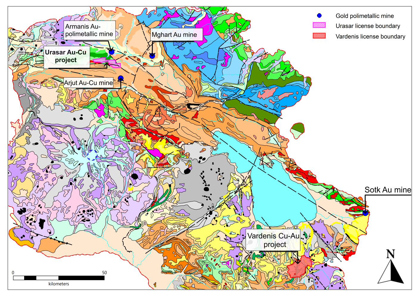
Urasar District: Result of Regional Reconnaissance
The area was first visited by Hayasa management In September 2021, when Urasar was one of ten prospects evaluated and sampled. It was ranked the highest priority due to wide-spread surface alteration/mineralization and encouraging geochemical results that comprised eight surface rock chip and channel samples, ranging from a minimum of 0.123 g/t Au to a maximum of 12.5 g/t Au, and averaging 2.65 g/t Au. Thirty follow-up rock chip samples were collected in November 2022 from other parts of the license area and returned an average of 0.75 g/t Au, and 6,285 ppm Cu. Based on opportunities such as the Urasar District, the availability of other well-mineralized prospects in Armenia, and a mining-friendly business environment, Hayasa management decided to set up a small office in Yerevan, the capital of Armenia, in mid-2022.
Historic Soviet-era Exploration at Urasar
The only significant exploration work undertaken at Urasar was carried out in the 1950’s through the early 1970’s by Soviet government exploration teams. The work focused on a 300 m wide, 8 km long quartz-sericite-pyrite alteration zone along the Chibukhlu fault and comprised 16 trenches, six adits and several drillholes (the latter not currently located). Three polymetallic precious metal deposits were defined based on Soviet era, non-NI 43-101 compliant resource models, named the Black River, Chibukhlu and Hanqakutak deposits. Other similarly mineralized areas were also identified as part of this work and constitute second order targets in upcoming programs. The figure below shows the location of two of the deposits as well as the prospects defined by this work.
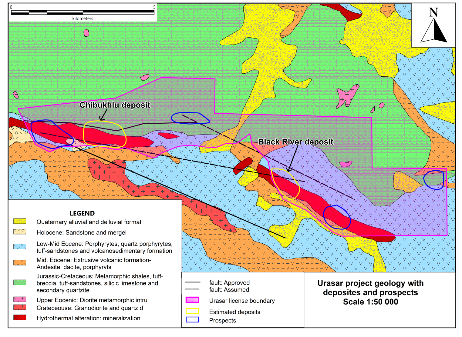
Patany Erkaban LLC based in Yerevan, Armenia, completed a mineral resource estimate for the three deposits in 2008 based on the Russian C1, C2 and P mineral resource categories using the Soviet historical data and including several duplicate drillholes. They estimated that the Black River deposit hosts 209,000 ounces Au in the C1+C2 categories and 334,000 ounces Au in the P category. The Chibukhlu deposit was reported to have good potential for Cu with up to 20,000 tonnes of Cu in the P category as well as 135,000 ounces Au in the C1+C2 categories and 315,000 ounces Au in the P category. The Hanqakutak deposit, which lies mostly outside of the Urasar license boundary, is estimated to host more than 500,000 ounces Au in the C1+C2 and P categories (ounces and tonnes have been rounded to the nearest 1,000).
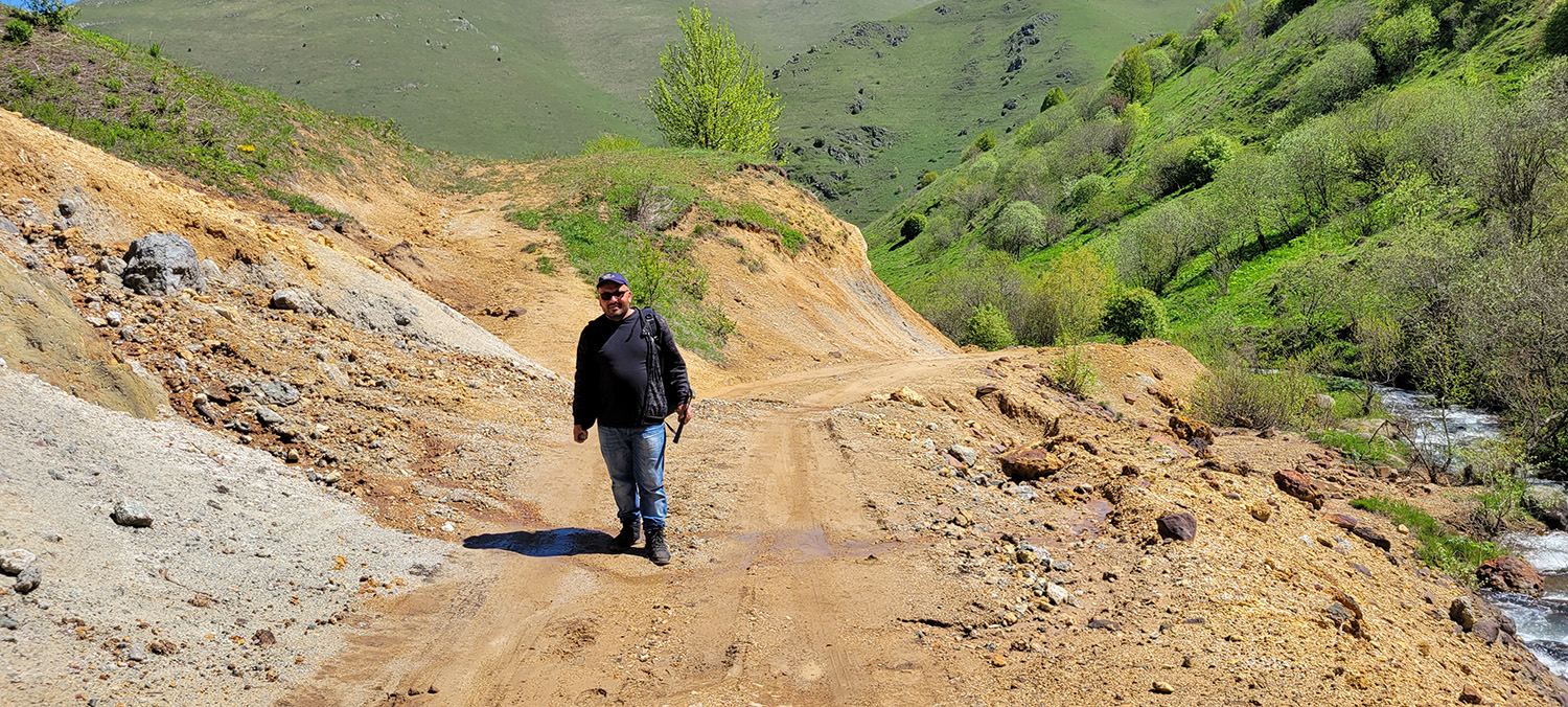
2023 Initial Soil Sampling
In late 2023 Hayasa conducted an initial geochemcial soil sampling program over the Urasar license comprising about 800 sample points over a 7km strike length. Sample density varied from 400m x 200m over areas between known mineralized zones, to as low as 200m x 50m over the areas defined as "deposits" by historic work. A program of ground geophyscics (ground magnetometer) and further soil smpling commenced in spril 2024.
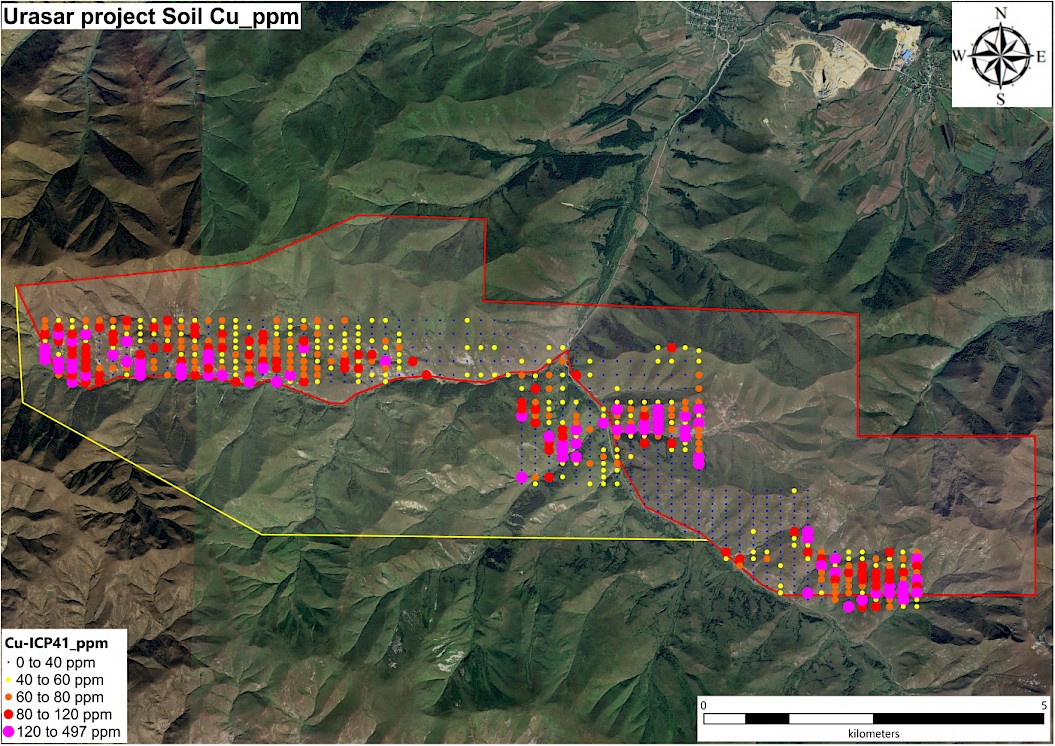
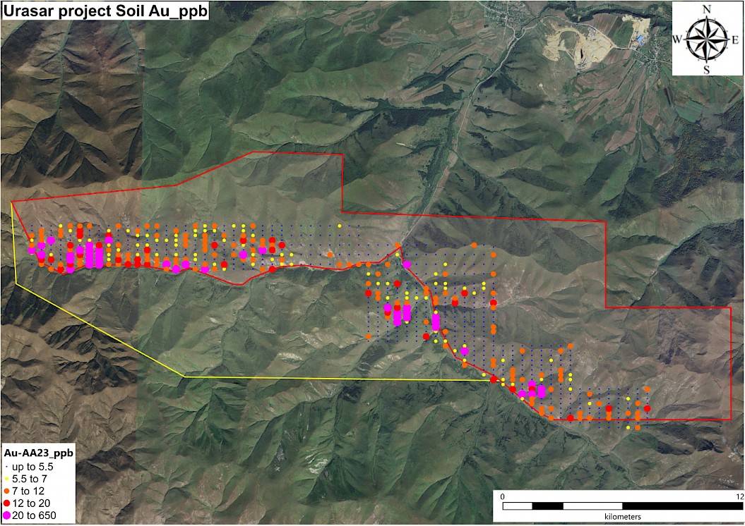
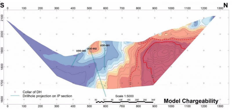
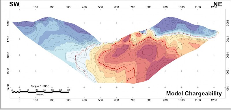
Comments on Urasar Terratec 2024 Ground Geophysical Survey: High Resolution Resistivity report
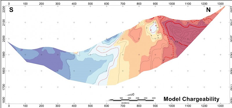
This survey provided a compelling look at the evolving geophysical and geological understanding of the Urasar project, particularly in light of the corrected HRIP pseudo-sections and the integrated chargeability-resistivity interpretations across the key lines.
Key Geophysical Interpretations:
1. Line 1:
- High chargeability + resistivity contrast (north-dipping): This classic geophysical combination could indicate sulphide mineralization (especially disseminated copper/gold), often seen in porphyry systems.
- High resistivity could represent silicification or fresh rock, while low resistivity may indicate alteration or clay zones. The chargeability will help differentiate between barren clays vs. sulphides.
2. Line 2:
- Chargeability high (800–1100m): Despite the fuzzier resistivity, the continuity with Line 1’s anomaly suggests a real, persistent subsurface feature. May represent a mineralized halo.
- Shallow resistor at 1050m: Could represent a silicified/mineralized zone.
3. Line 3:
- North-dipping resistor with subdued chargeability: Might be an alteration zone or more distal facies of the mineralized system.
- Anti-form/syn-form couplet: Could be tectonic or weathering-related; distinguishing between these will be important to avoid misinterpreting false anomalies.
Summary of 2025 Drilling
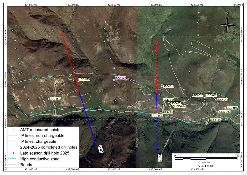
- UDD-021 was the best hole returning 39m of 0.5% Cu near surface with 1.9 g/t Au over the same interval
Strategic Implications:
- A late summer 2025 AMT survey was completed as planned drilling concluded; identication of an anomaly shown below spurred the 2025 late season hole.
- This was our best hole to date at Urasar and based on this success and the results of the condensed AMT survey, Hayasa will completed an extended AMT survey in May 2026. We have started a 1,000m drilling program, estimated to be completed in July 2026.
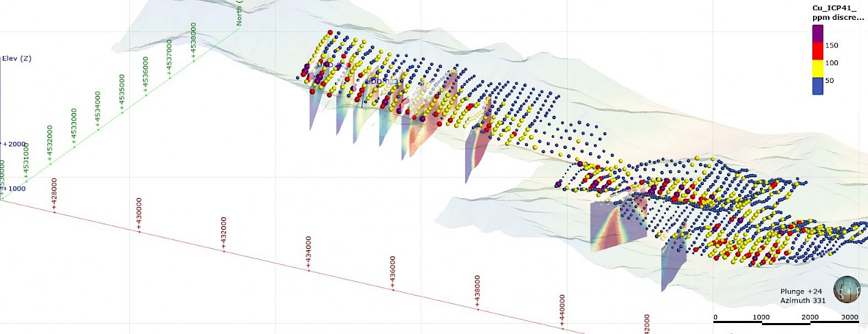
Urasar 2026 AMT 6 line Survey
Please see Terratec report below for cross section images